
So about 6 or 7 months ago I stumbled across this website and fell in love...yes, I am a big geek.
http://projects.nytimes.com/census/2010/explorer?view=raceethnicity&lat=38.9164&lng=-77.014&l=12
It lets you type in your area code and see really intersting things about each census track (data is from 2005-2009).
You can see race, income, housing, education, etc ---- it is fascinating to see how people have clustered and how closely disparities and geography are linked. I would be interested to map on health issues based on various demographics.
Here are a few stat's that startle me:
- The census track right above me (lullwater, druid hills area) has 78% of elementary kids in private school even though they are zoned for an amazing school that is well ranked (morningside and springdale park!)
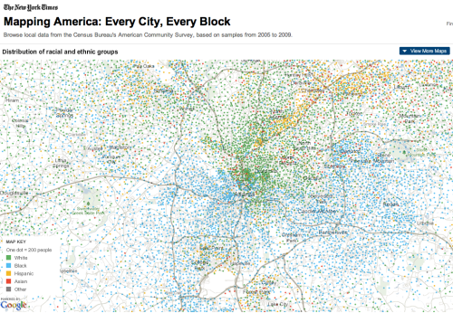
Below is a map of the distribution of racial/ethnic groups in Atlanta:


1 comment:
This just proves my point that Atlanta is a CRAZY place...I feel like the pocketing is so extreme here compared to other cities.
Post a Comment